I watched this last night on Channel 4 News. In this area if the USA where climate change is clearly effecting and will eventually destroy, denial is rife. They voted 90% for Trump and are already erecting signs for his reelection in 2020. They deny evolution and cling to their God and guns. Thoughts of false consciousness and hegemony drift through my mind. Both Gramsci and Marx had much to say about such a phenomena .

Yet when I watched All Gore speak as a representative of the political
elite I understood why. When Tiny Blair took class consciousness and
ideology away he opened the door to Farage and Trump. It was the third
way that begat the horrors if Trump and Farage and made people feel all
politicians the same . Now those fooled by Trump will inherit the wind
of climate change. ..Trump Farage and Blair all needed a depoliticised
working class that had lost the vital tools of critical thinking and
reflection.....to adapt Dylan "if you see them say hello, they might be
in Tangier
Subscribe to France 24 now: http://f24.my/youtubeEN FRANCE 24 live news stream: all the latest news 24/7 http://f24.my/YTliveEN Donald Trump has previous
Tangier, Virginia
Tangier is a town in Accomack County, Virginia, United States, on Tangier Island in Chesapeake Bay. The population was 727 at the 2010 census.[3] Since 1850, the island's landmass has been reduced by 67%. Under the mid-range sea level rise scenario, much of the remaining landmass is expected to be lost in the next 50 years and the town will likely need to be abandoned.[4]Tangier Island, Virginia Town  Tangier, Virginia seen from the County Dock, June 2017
Flag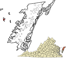
Location in Accomack County and the state of VirginiaCoordinates: 37°49′33″N 75°59′32″WCoordinates: 37°49′33″N 75°59′32″W Country United States State Virginia County Accomack Area • Total 1.2 sq mi (3.2 km2) • Land 1.2 sq mi (3.2 km2) • Water 0.0 sq mi (0.0 km2) Elevation 3 ft (1 m) Population (2010) • Total 727 • Density 590/sq mi (230/km2) Time zone Eastern (EST) (UTC-5) • Summer (DST) EDT (UTC-4) ZIP code 23440 Area code(s) 757 FIPS code 51-77520[1] GNIS feature ID 1500206[2] Website www .tangierislandva .com
The people who came to settle the island permanently arrived in the 1770s and were farmers. In the late 19th Century, the islanders began to become more dependent on harvesting crabs and oysters from the Chesapeake Bay.[5] As the waterman livelihood became more important and more lucrative, there were often conflicts among the oyster dredgers and oyster tongers in the bay, and between those living in Maryland and those living in Virginia.[6]
Many who live on Tangier speak a distinctive dialect of American English,[7] which scholars have disputed as derived from a 17th Century English lexicon and phonetics. Linguist David Shores has noted that, while it may sound like a British or Welsh variety of English, the dialect is a creation of its own time and place off the eastern shore of Virginia.[8] The persistence of this dialectal variety is often attributed to the geographic isolation of the population from the mainland. Tangier Island is listed on the National Register of Historic Places.[9]History
Prior to the arrival of colonists on Tangier Island, it was a retreat for the Pocomoke Indians[10] for centuries. Although not much is known about these people, their existence is evidenced by the thousands of stone arrowheads that have been found all over the island. Almost any morning after gale-force winds have been blowing all night, new arrowheads can be found on the beach. The discovery of an ancient offshore oyster midden, thousands of years old and containing a huge pile of shells which could only have been deposited by humans, is further evidence that there was a regular population on Tangier, at least in the warm part of the year, long before it had an English name. The enormous numbers of arrowheads and spear points found here suggest the island was probably much larger than recorded history can verify and was home to many animal species.[citation needed]
The first known European explorer of the island was John Smith. He named Tangier and the surrounding islands the "Russel Isles" after the doctor on board his ship and for what he thought was the resemblance the area bore to the "original" Tangier, Morocco.[11]
In 1670, Ambrose White received a patent for 400 acres (160 ha) called "an Island in the Chesapeake Bay". The next year White assigned his patent to Charles and John West. In 1673 William Walton was granted 400 acres (160 hectares) on the western island which was formerly patented by White. There is a similar entry in the patent book three years later, but Scarburgh and West were the recipients instead of Walton, and in 1678 a formal patent was issued to both of them. Charles Scarburgh (often now spelled Scarborough) left his interest to his wife Elizabeth in 1702, and John West's interest went to his eldest son a year later. In 1713, two patents were granted to Elizabeth Scarburgh and Anthony West for Tangier Islands. One was for 900 acres (360 ha), which included the original 400 acres (160 ha) plus 500 acres (200 ha) more found within its bounds. The other grant was for 170 acres (69 ha) of new land south of Tangier called "Sandy Beach Island" which was probably the hook-shaped part that is now attached to the main of the island. This was the first time Tangier Islands was named in the records. Although Elizabeth Scarburgh left her interest to her daughters, the title went to her oldest son, Bennett. It then passed to Henry Scarburgh and then to a Charles Scarburgh. In 1762, Charles Scarburgh confirmed an undeeded sale of his half to Colonel Thomas Hall. The next year Hall sold this to William Andrews as 475 acres (192 ha).
Today many of the inhabitants have the surname Crockett, which was the name of the first permanent Anglo-American settler in the late 18th Century. Other common surnames on the island include Pruitt, Thomas, Marshall, Charnock, Dise, Shores, and Parks. By 1900 there were 1,064 inhabitants.
The British used the island as a staging area during the War of 1812, when there were as many as 1,200 British troops recorded on the island at one time. Many slaves escaped to the British on Tangier and were given their freedom. Some joined the Corps of Colonial Marines. When a dozen British sailors were captured, their account of hardships encountered with shortages of food and water on the island, and the building of Fort Albion, were reported in a local newspaper.[12] Tangier was used for the failed British assault on Baltimore, which was the influence for Francis Scott Key's writing of "The Star-Spangled Banner".[13]
The original church on the island was called Lee's Bethel and burned down in the 19th Century. A bench marking its location is in the graveyard in Canton. The present-day church on the island, Swain Memorial Methodist Church, was established in 1835. The other church is called the New Testament Congregation, established in 1946, a non-denominational Christian place of worship. For various reasons, both historical and practical, burials are sometimes located in the yards of houses. There are also churchyard cemeteries at each of the island's churches.
 Three 21st Century hurricanes, Isabel, Ernesto, and Sandy, caused much of the island to flood. A few houses were abandoned or torn down due to storm damage, while others have been elevated on new foundations. New buildings continue to be built on the island.A typical cemetery on the island, showing overcrowding
In the 1960s, the US Army took over portions of Tangier Island by eminent domain, forcing some residents including Walter Crockett and Maggie Eskridge Crockett to move to the mainland (Exmore, Virginia), so the US Military could conduct missile testing. [14] [15] [16] Many of Tangier's residents believe that these operations were part of the reason for current erosion problems.
Geography
Tangier is located on an island in a part of the Chesapeake Bay. It is made up of sandy ridges divided by marshes and tidal streams. The islands are connected by bridges. The island has three ridges, called Main Ridge, Canton, and West Ridge. North of Tangier is an island which was abandoned after the stream between the two islands (Oyster Creek) became too wide to build a bridge over. This northernmost area is called Uppards, and originally had a neighborhood called Canaan. The only structures left on Uppards are duck hunting lodges from 1928. A few of the homes on Main Ridge were moved from Uppards before flooding became a major problem. Each of the ridges have neighborhoods. On the northern part of Main Ridge, the neighborhood is called Meat Soup. On the northern part of West Ridge it is called Sheep's Hill. On the southern part of Main Ridge it is called Black Dye, and on the southern part of West Ridge it is called Hog Ridge. Canton is in the most southeastern area of the island and is reached via a bridge. The bridges over the largest channel, called the Big Gut, are, to the north, Long Bridge, School Bridge, Wallace Bridge, and the farthest south is Heisten Bridge.
 Because of its distance from the mainland, Tangier is sometimes considered isolated. The closest inhabited areas, and those most frequently traveled to and from, are Crisfield, Maryland; Onancock, Virginia; Reedville, Virginia; and other islands such as Smith Island, Maryland. The modes of transportation off the island are boats and airplane. There is an airport, open from dawn to dusk.[17] There are two boats that travel regularly from Crisfield, Maryland, across Tangier Sound to Tangier. Passengers and the mail are carried on these boats. The mail boat, the Courtney Thomas, leaves Tangier at 8:00 am, and leaves Crisfield at 12:30 pm. The Steven Thomas, a 300-passenger cruise boat, leaves Crisfield at 12:30 pm during the summer season from Memorial Day weekend through mid-October; departs Tangier at 4:00 pm. In the summer season, the Chesapeake Breeze travels daily from Reedville, Virginia, on the Western Shore, leaving there at 10:00 am, and leaving Tangier at 2:00 pm. The ferry service from Onancock on the Joyce Marie was revived in 2009.[18]The marshes outside of town
 With all of these means of transportation and regular telephone service, residents have regular ways of staying in touch with the mainland. The island also has cable television and internet service. There is a calm, peaceful atmosphere on the island, with four delightful gift shops, a number of restaurants, and a hardware store as retail establishments. There are no arcades, no drug stores or department stores, no traffic lights, and violent crime is virtually nonexistent.[citation needed] There are two bed and breakfasts for overnight guests, and a wild beach without a boardwalk or concessions. There is a historical museum and interpretive cultural center. There is one ATM on the island. Most of the gift shops, eating establishments, and overnight accommodations accept credit and debit cards. Tangier is known for its seafood dishes, especially its soft-shell crab sandwiches. These can be found at its restaurants including the Fisherman's Corner. Children often sell lemonade and Christmas decorations made from sea shells to tourists. In the evenings, the playground across from the school is a nice place for children to unwind, or the 1950s-style, centrally air conditioned ice-cream parlor on Main Ridge, called Spanky's.Tangier's post office
The major new addition to the island has been the Tangier Island History Museum,[19] which created the historical markers that line Tangier’s streets and provide a “historical tour” of the island. Tour guides are also available to offer visitors a narrated ride around the island. The museum’s artifacts are donated or loaned by local residents. The museum also operates a small community library, "Muddy Toes." Visitors often rent kayaks to follow local “water trails." These trails guide visitors around the watermen’s crabbing shacks built on stilts in Tangier Harbor, to navigate the saltwater “guts” that separate the island, or to visit “the Uppards”, a marshy island just to the north of Tangier that used to have a sizable community until it was abandoned in 1928. Immediately to the east of Tangier, also a kayak paddle away, is Port Isobel,[20] a small island owned by the nonprofit Chesapeake Bay Foundation,[21] which operates an environmental study and retreat center there. Port Isobel’s hiking trails are open to the public but the low-lying marshland is ideal breeding grounds for mosquitoes and biting flies, so bug repellent is strongly recommended for anyone visiting.[22]
There are few places in the United States with more waterfowl.[citation needed] Tangier marshes are home to many birds, including pelicans, blue herons, rails, egrets, several varieties of ducks and geese, and osprey.
Tangier is located at 37°49′33″N 75°59′32″W.[23] According to the United States Census Bureau, the town has a total area of 1.2 square miles (3.2 km2), all of it land.[24]
Including the surrounding marshes, Tangier Island totals less than 740 acres (300 hectares), but only 83 acres (34 hectares) are high enough for habitation. The highest point of land is barely four feet above sea level, and about 9 acres (3.6 hectares) of Tangier shoreline are estimated to erode into the Chesapeake each year. Local residents see their existence threatened from falling catches, state regulation of the waterman livelihood on the Chesapeake Bay, constant erosion, and increasingly frequent flooding.[25]
Language
The local accent is sometimes compared to that of the "Hoi Toiders" of the Outer Banks of North Carolina. There are some similarities, but the dialects are distinct. Before bridges were built, the only form of transport between or off the ridges was by boat, which allowed for the islands to stay isolated from the mainland. Smith Island, Maryland has a more similar dialect in terms of phonetics and lexicon to that on Tangier.[26]
This section does not cite any sources. (August 2013) (Learn how and when to remove this template message)
Economy
Today, the inhabitants of Tangier rely on crabbing to make a living. Tangier is often referred to as the "soft-shell crab capital of the world". Most fishermen catch and sell crabs and oysters. North of the island are many free-standing docks not connected to land which fishermen use to hold crabs while they moult. Oystering is also a major industry. The island also has a long history of graduates joining the military and being called to become pastors.
 The primary industry on the island besides fishing is tourism.[27] During the summer, several cruise ships come to the island each day, allowing passengers to explore and buy goods from the islanders. Two bed-and-breakfast inns can accommodate a limited number of overnight guests. There are several restaurants and gift shops for the tourist-trade. Some residents outfit golf carts with passenger trailers to offer "historical tours" of the island. The roads on Tangier are wide enough for two golf carts. Tourists and islanders often use golf carts, boats, mopeds, and bikes, but some have trucks and cars.Typical transport on the island
Institutions
The Tangier Island Health Foundation[28] runs a health center on Tangier, which is operated by the Riverside Health System,[29] which also operates on Virginia's Eastern Shore and in Hampton Roads. Historically, there were two cases of Tangier disease, a recessive genetic disorder which causes high blood cholesterol, which, following discovery, was named after the island. There are very few residents with this genetic anomaly who currently live on the island.[30][31]
 There is one school on the island, part of Accomack County. The principal holds a doctoral degree and all teachers are certified to teach in the state of Virginia. The school serves students in preschool through the 12th grade.Swain Memorial United Methodist Church
The residents of Tangier enjoy regular cable television and Internet through a new microwave tower installed in spring 2010. There are phone lines on the island. One physician's assistant and a number of registered nurses live on the island. David Nichols treated residents for thirty years piloting a Cessna 182 or Robinson helicopter for once a week visits.[32] In January 2007, he was profiled by ABC World News Tonight as its Person of the Week.[33] Nichols died at the age of 62 on December 30, 2010, after a battle with cancer. Four months earlier, a new clinic was christened in his name.[34] Emergency patients travel by helicopter to Crisfield or Salisbury hospitals in Maryland. Although the island has one operational power plant, it is mainly used for emergencies. Power comes in from the Eastern Shore of Virginia through an underwater cable.
Methodism has been and remains a very strong influence on Tangier, stemming from the charismatic preaching and revival camp meetings held there in the early 1800s by Joshua Thomas, the famed “parson of the islands.” Because of their ties to the Northern Methodist Church, Tangier residents in the 19th Century did not support slavery and did not join Virginia in seceding from the Union during the Civil War. Religious values are very important to the community. A local ordinance prohibits the sale of alcohol, making the island "dry." In 1999, the Tangier town council blocked Warner Brothers from using the island to film the Kevin Costner film Message in a Bottle, objecting to the script’s drinking, profanity and sex. If visitors bring their own alcohol, they are advised to be discreet and not drink it in public.[22]
Sports
According to the current mayor of Tangier, James "Ooker" Eskridge, many island inhabitants were concerned the way of life on the island would change as the result of getting high-speed Internet in spring 2010. However, he indicated the change was for the better as islanders "developed quite the appetite for streaming sports".[35] Recognizing the impact of sports on the island community, and believing it may be a boost to the island's tourism, the Virginia Tourism Authority (VTA) declared Tangier Island the biggest sports town in America, per capita. The VTA presented the island with a plaque to commemorate the occasion. This phenomenon became the basis for a commercial for ESPN.[36]
Demographics
As of the census[1] of 2000, there were 605 people, 244 households, and 181 families residing in the town. The population density was 2,448.2 people per square mile (932.8/km2). There were 270 housing units at an average density of 1,094.4 per square mile (417.0/km2). The racial makeup of the town was 99.50% White and 0.50% African American. In 2006, there are four people from Eastern India, one African American, one Pacific Islander, and several people of American Indian extraction. Many people have familial ties with residents of the Eastern Shore of Virginia as well as places on the western shore, such as Reedville and Urbanna.Historical population Census Pop. %± 1910 698 — 1920 962 37.8% 1930 1,120 16.4% 1940 1,020 −8.9% 1950 915 −10.3% 1960 876 −4.3% 1970 814 −7.1% 1980 771 −5.3% 1990 659 −14.5% 2000 604 −8.3% 2010 727 20.4% Est. 2016 722 [37] −0.7% U.S. Decennial Census[38]
There were 244 households out of which 27.5% had children under the age of 18 living with them, 61.1% were married couples living together, 9.4% had a female householder with no husband present, and 25.8% were non-families. 25.0% of all households were made up of individuals and 16.8% had someone living alone who was 65 years of age or older. The average household size was 2.48 and the average family size was 2.94.
In the town, the population was spread out with 21.5% under the age of 18, 6.6% from 18 to 24, 24.3% from 25 to 44, 29.0% from 45 to 64, and 18.5% who were 65 years of age or older. The median age was 43 years. For every 100 females there were 101.3 males. For every 100 females age 18 and over, there were 100.0 males.
The median income for a household in the town was $26,607, and the median income for a family was $28,636. Males had a median income of $19,167 versus $20,750 for females. The per capita income for the town was $24,042. About 22.6% of families and 27.5% of the population were below the poverty line, including 39.8% of those under age 18 and 12.8% of those age 65 or over.
Climate
The climate in this area is characterized by hot, humid summers and generally mild to cool winters. According to the Köppen Climate Classification system, Tangier has a humid subtropical climate, abbreviated "Cfa" on climate maps.[39]
Erosion of the island
Many residents believe that erosion is to be blamed for the increasing incidence and severity of flooding.[40] A 2015 study by a member of the Army Corps of Engineers concludes that Tangier has 25–50 years of habitability remaining and that the subsidence of the ridges is ongoing since at least the mid-19th century. The authors also conclude that the primary causes of the subsidence in the southern Chesapeake Bay region is sea-level rise due to the melting of the Laurentide ice sheet, groundwater extraction on mainland Virginia, and the remaining effects of a meteor impact near Cape Charles, Virginia 35.5 million years ago.[4]
The town has been talking with political representatives for decades to get protection for the island in the form of jetties or sea walls. The Town, the History Museum, and townspeople continue to raise money for their sea wall fund.[41] In 2017, CNN aired a story about Tangier that featured the town's Mayor, James W. Eskridge. President Donald Trump called the mayor personally to assure him that the town would survive.[42][43][44][45]
See also
References
- "American FactFinder". United States Census Bureau. Archived from the original on 2013-09-11. Retrieved 2008-01-31.
- "US Board on Geographic Names". United States Geological Survey. 2007-10-25. Retrieved 2008-01-31.
- "Profile of General Population and Housing Characteristics: 2010 Demographic Profile Data (DP-1): Tangier town, Virginia". U.S. Census Bureau, American Factfinder. Archived from the original on September 11, 2013. Retrieved April 5, 2012.
- Schulte, David M.; Dridge, Karin M.; Hudgins, Mark H. (2015-12-10). "Climate Change and the Evolution and Fate of the Tangier Islands of Chesapeake Bay, USA". Scientific Reports. 5 (1). ISSN 2045-2322. PMC 4675185
 . PMID 26657975. doi:10.1038/srep17890.
 - Mariner, Kirk (1999). God's Island: the History of Tangier. Onancock, Virginia: Miona Publications. pp. passim.
- Botwick and McClane (2005). "Landscapes of resistance: a view of the nineteenth-century Chesapeake Bay oyster fishery". Historical Archaeology. 39: 94–112.
- People Like Us - The CNAM Channel (2008-02-22), The odd accent of Tangier VA - American Tongues episode #3, retrieved 2017-07-20
- Shores, David L., Tangier Island: Place, People and Talk (Cranbury, NJ: Associated University Presses, 2000), 1.
- "Tangier Island Historic District". National Park Service. Archived from the original on 18 July 2017.
- "Pocomoke Indian Nation". Pocomoke-indian-nation.org. Archived from the original on 2012-01-04. Retrieved 2012-09-22.
- Virginia Taylor. "Tangier Island History and the Tangier History Museum". Tangierisland-va.com. Retrieved 2012-09-22.
- "Farmer's Repository, July 28, 1814". Genealogybank.com. Retrieved 2012-09-22.
- Miller, John J. (2005-08-02). "Exotic Tangier". National Review. Retrieved 2008-03-04.
- https://www.gpo.gov/fdsys/pkg/CFR-2002-title33-vol3/pdf/CFR-2002-title33-vol3-sec334-210.pdf
- https://www.gpo.gov/fdsys/pkg/CFR-2002-title33-vol3/pdf/CFR-2002-title33-vol3-sec334-210.pdf
- https://www.gpo.gov/fdsys/search/pagedetails.action?collectionCode=CFR&searchPath=Title+33%2FChapter+II%2FPart+334&granuleId=CFR-2002-title33-vol3-sec334-210&packageId=CFR-2002-title33-vol3&oldPath=Title+33%2FChapter+II%2FPart+263%2FSubpart+D&fromPageDetails=true&collapse=true&browsePath=Title+33%2FChapter+II%2FPart+334%2FSection+334.210&fromBrowse=true
- Tangier Island Airport FAA information
- Chesapeake Bay Magazine : Tangier-Onancock Ferry Route Back in Business : April 14 2009 Retrieved February 25, 2010
- Tangier Island History Museum
- Port Isobel
- Chesapeake Bay Foundation
- Stephen Blakely (September 2010). “Tangier Island, Va.” Soundings.
- "US Gazetteer files: 2010, 2000, and 1990". United States Census Bureau. 2011-02-12. Retrieved 2011-04-23.
- "Geographic Identifiers: 2010 Demographic Profile Data (G001): Tangier town, Virginia". U.S. Census Bureau, American Factfinder. Archived from the original on September 11, 2013. Retrieved April 5, 2012.
- Scott Harper, Virginia Pilot, May 12, 2012, “Residents of drowning Tangier Island look for lifeline”
- Schilling-Estes, Natalie (1997). "Accommodation versus concentration: dialect death in two post-insular island communities". American Speech. 72: 12–32.
- Jackson, Candace (September 22, 2007). "Virginia's Time Machine - WSJ.com". The Wall Street Journal. New York: Dow Jones. ISSN 0099-9660. Retrieved September 1, 2011.
- "Tangier Island Health Foundation". Archived from the original on 19 July 2017.


No comments:
Post a Comment